Accurate 3D spatial intelligence
We transform imagery, LiDAR and point cloud data into accurate 3D products for planning, engineering, asset management, simulation and visualization.
Discuss Your Needs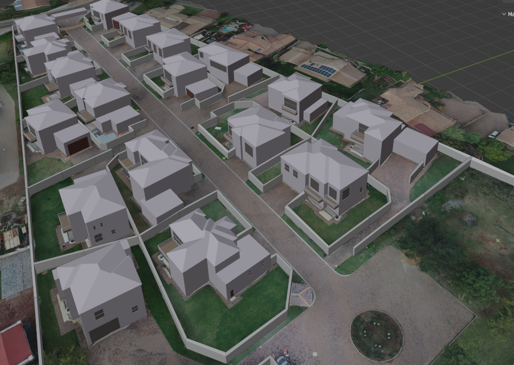
Accurate, georeferenced 3D models for planning, engineering and decision-making.
Aphelion World provides 3D modelling and mapping services that convert UAV imagery, LiDAR, airborne data, satellite imagery and point clouds into reliable three-dimensional geospatial products. Our outputs support infrastructure planning, asset monitoring, environmental analysis, disaster risk assessment, digital twins and immersive visualization.
We focus on producing 3D data that is not only visually useful, but also spatially accurate, measurable and compatible with GIS, CAD, BIM and web-based visualization environments.
What we deliver
- Point cloud processing, classification, cleaning and optimization.
- Digital Surface Models, Digital Terrain Models and elevation products.
- Textured 3D meshes and georeferenced 3D city or site models.
- UAV and photogrammetric mapping workflows for high-resolution 3D reconstruction.
- LiDAR-derived terrain, infrastructure and vegetation structure products.
- BIM and GeoBIM-ready outputs for engineering and asset management workflows.
- 3D visualization assets for simulation, digital twins, AR, VR and stakeholder communication.
Application areas
Our 3D mapping products can support infrastructure inspections, mining and industrial site monitoring, urban development, flood and terrain modelling, utilities planning, road and corridor mapping, building reconstruction, forestry structure analysis and environmental impact assessment.
Our approach
We combine photogrammetry, point cloud processing, geospatial analysis and software engineering to produce 3D outputs that can be used in real operational workflows. Each project is designed around the required accuracy, scale, coordinate reference system, data source, delivery format and end-user application.
Point Cloud Processing
Cleaning, classification, thinning, tiling and optimization of LiDAR and photogrammetric point clouds.
Elevation Products
DEM, DSM, DTM and contour products for terrain analysis, hydrology, engineering and planning.
3D Models & Meshes
Textured meshes, 3D buildings, site models and visualization-ready 3D assets.
BIM / GeoBIM Integration
Geospatially referenced 3D outputs that support CAD, BIM, asset management and digital twin workflows.
Whether you need a high-resolution site model, a terrain surface for flood modelling, a 3D infrastructure dataset or a visualization-ready digital twin, Aphelion World can help convert your spatial data into reliable 3D intelligence.
Contact Us